30 de agosto de 2012

SUSTENTABILIDADE, ORDENAMENTO DO TERRITÓRIO E AMBIENTE

Sérgio Palma Brito

Capítulo 1
INTRODUÇÃO à HISTÓRIA do VIAJAR e à FORMAÇÃO do TURISMO em PORTUGAL
...

Durante o período que vai de meados dos anos 50 do século XX à crise de 2008-2009, concentramo-nos na formação da oferta de turismo resultante da procura massificada e sazonal da viagem para estanciar durante o tempo livre. É esta oferta de turismo que está no cerne da relação entre turismo, ambiente e ordenamento do território, a qual constitui a base do conceito de sustentabilidade.
A política e a administração do turismo começam por se preocupar com o turismo cultural, urbano e termal e, numa menor dimensão, com o das praias. A partir do início dos anos 60 do século XX, a mutação da oferta de turismo, sobretudo no Algarve, coloca novos problemas quanto à sua relação com esta última oferta de turismo (com destaque para o turismo residencial) e com a política e a administração do ordenamento do território e do ambiente.
...

Urbanização Turística

Anos 60 a 90: Urbanização Turística Dispersa

«Urbanização turística» designa a concentração crescente das populações que podem viajar para estanciar durante o tempo livre em estâncias ou zonas de turismo (no passado), e em núcleos turísticos, núcleos e urbes urbano-turísticas e edificação dispersa, integrados ou não numa área turística (no presente).
Entre os anos 60 e 90 forma-se no Algarve uma urbanização turística dispersa, caso especial da urbanização dispersa que então prolifera por todo o País, com edificação legal ou clandestina, e que está na origem de parte das actuais fraquezas da urbanização em Portugal. É a primeira patologia do povoamento urbano do Algarve, utilizando-se o termo «patologia» no sentido económico, social e político de «excessos de uma prática a que falta regulação», e não no sentido biológico.
Durante cerca de um quarto de século, esta urbanização turística dispersa compreende duas formas distintas:

► O «núcleo turístico fora dos perímetros urbanos», com urbanismo turístico em «ambiente de resort», criado na maior parte dos casos pela urbanização estruturada de propriedades cuja área varia entre alguns hectares e os 16 km de Vilamoura. Estes núcleos passam por processos de expansão orgânica («arredondamento»), de densificação das áreas iniciais e de reconversão estruturante (caso de Vilamoura em Vilamoura XXI);
► O «núcleo urbano-turístico», resultante da transformação dos núcleos urbanos da vilegiatura tradicional, por expansão orgânica para a periferia ou densificação da edificação urbana no seu seio, ou por ambos os processos. Alguns destes núcleos formam-se a partir de aglomerados piscatórios que, dada a sua irrelevância, não são sequer objecto do planeamento urbanístico anterior a 1962.

Datam também desta altura:

► a edificação dispersa de utilização turística, de que são exemplo as moradias construídas no Cerro da Águia, a poente de Albufeira;
► aquilo que, dezenas de anos mais tarde, se designará por estabelecimentos hoteleiros isolados ...

A urbanização turística integra dois tipos de espaços cuja dinâmica é inseparável do turismo residencial:

► A prática do golfe ...;
► As marinas ...

Ruptura Política dos Anos 90 e Novas Formas de Urbanização Turística

A ruptura política dos anos 90 está na origem de duas novas formas de urbanização turística. A primeira assenta na consolidação da urbanização turística dispersa e compreende duas dinâmicas similares, mas diferentes na escala:

► A consagração da expansão de «núcleos urbano-turísticos» preexistentes, pela definição de perímetros urbanos mais ou menos generosos – um processo que ultrapassa, em muito, os limites do Algarve e de que são exemplo os núcleos de desenvolvimento turístico do PROTALI de 1993;
► No Algarve, começam a formar-se quatro «urbes urbano-turísticas» (do Alvor a Praia da Rocha, Armação de Pêra e Albufeira e de Vilamoura a Quarteira) que se distinguem pela sua escala e pela formação, a norte, de largas frentes de mar, segundo dois movimentos: a expansão orgânica do núcleo urbano-turístico inicial; e a integração de outros focos da dinâmica urbana dispersa, localizados a poucos quilómetros deste núcleo.

Na sub-região do litoral do Algarve, a escala da procura faz com que estas quatro urbes e uma consolidação mais intensa nos «núcleos urbano-turísticos» contribuam para formar uma economia turístico-residencial única em Portugal. Encontramos algo deste modelo na urbanização que actualmente vai dos Estoris até à Guia, no concelho de Cascais.

A segunda forma de urbanização turística é a dos núcleos turísticos de nova geração. Estes núcleos são uma nova e mais sofisticada forma do «núcleo turístico fora dos perímetros urbanos» após quase 30 anos de urbanização turística dispersa.

Edificação Dispersa

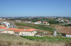
A edificação dispersa é um problema em várias regiões do País, sendo utilizada para residência permanente ou casa para viver o tempo livre com a possibilidade de alternar ou conciliar estas utilizações. A vivência do tempo livre começa por ter lugar na proximidade dos grandes centros urbanos (onde nasce a designação de «casa de fim-de-semana») ou em áreas turísticas cujo exemplo mais significativo é o Algarve.
No caso do Algarve da actualidade, edificação dispersa designa a transformação da dinâmica de dispersão e concentração de «habitações dispersas» do povoamento rural do Algarve de 1962 pela utilização como casa do tempo livre ou residência permanente da população local. Inclui a recuperação de habitação da população rural e novas edificações cujo licenciamento assenta em criativas interpretações das disposições legais que pretendem limitá-la ou proibi-la.
Esta definição de edificação dispersa não inclui a aparente dispersão física das moradias de um conjunto urbanístico (Vilamoura ou Quinta do Lago), nem a edificação dispersa de cariz suburbano e mais concentrada verificada na proximidade de uma cidade; e é diferente da morfologia de empreendimento de turismo residencial, que designamos por «estruturação da exploração de moradias dispersas».

Link para o texto integral:
http://www.spi.pt/turismo/Manuais/Manual_II.pdf

29 de agosto de 2012

Darkness on the Edge of Town: Mapping Urban and Peri-Urban Australia Using Nighttime Satellite Imagery

Paul C. Sutton and Andrew R. Goetz - University of Denver
Stephen Fildes and Clive Forste - Flinders University, Australia
Tilottama Ghosh - University of Denver

This article explores the use of nighttime satellite imagery for mapping urban and peri-urban areas of Australia. A population-weighted measure of urban sprawl is used to characterize relative levels of sprawl for Australia’s urban areas. In addition, the expansive areas of low light surrounding most major metropolitan areas are used to map the urban–bush interface of exurban land use. Our findings suggest that 82 percent of the Australian population lives in urban areas, 15 percent live in peri-urban or exurban areas, and 3 percent live in rural areas. This represents a significantly more concentrated human settlement pattern than presently exists in the United States.

Urban Decentralization Processes

Methods

Results and Discussion
Conclusion

Nighttime satellite imagery has been used to map urban and an exurban population in the United States and this article demonstrates that the same methods are reasonable for mapping similar urban and exurban environments in Australia. Comparing these results with prior studies of U.S. cities shows that Australia is significantly more urban than the United States and Australia’s urban areas do not sprawl in either an urban or peri-urban way relative to those in the United States. Within Australia, Sydney sprawls the least and Brisbane sprawls the most. Perth sprawls a bit, but Melbourne and Adelaide do not. Comparing the peri-urban populations and areal extent of these five big cities is problematic due to the differing degree of conurbation they have with nearby large cities (e.g., Sydney with Newcastle and Woo- longong; Brisbane with the Gold Coast; Perth with Freemantle and Mandurah; Melbourne with Geelong; and Adelaide with Mt. Barker). Future demographic, economic, social, political, and ethical decisions and nondecisions will determine whether Australia will move toward or away from the urban and exurban sprawl that presently exists in the United States.

Literature Cited
in:
Sutton, Paul C., Goetz, Andrew R., Fildes, Stephen, Forster, Clive and Ghosh, Tilottama(2010) 'Darkness on the Edge of Town: Mapping Urban and Peri-Urban Australia Using Nighttime Satellite Imagery', The Professional Geographer, 62: 1, 119 — 133, First published on: 11 December 2009 (iFirst)

link para o texto integral:
http://urizen-geography.nsm.du.edu/~psutton/AAA_Sutton_WebPage/Sutton/Publications/Sut_Pub_9.pdf

28 de agosto de 2012

Que futuro para antigas fábricas abandonadas?

Conceição Melo

Jornal "Público"
20-08-2012

A Fábrica de Fiação e Tecidos de Santo Thyrso foi uma das mais emblemáticas fábricas do Vale do Ave, coração da indústria têxtil e do vestuário português, tendo empregado nos seus tempos áureos mais de mil trabalhadores. Por este motivo, existe ainda hoje uma forte ligação sentimental da população para com este espaço. Pioneira no desenvolvimento industrial da região, esta fábrica não resistiu às mudanças estruturais do sistema económico e produtivo que, nos anos oitenta, colocaram desprotegidamente as nossas indústrias no mercado global. Fechou as suas portas em 1990.

Ultrapassando as suas competências estritas, a câmara municipal iniciou um longo processo para a aquisição deste património, aceitando o desígnio de manter viva a memória e a identidade coletivas.

A requalificação da Fábrica de Santo Thyrso enquadra-se numa intervenção de regeneração urbana mais alargada que visa tornar as frentes ribeirinhas do rio Ave um espaço de sociabilidade e de fruição para todos os habitantes, turistas e visitantes de Santo Tirso, ao qual se associa a promoção de atividades culturais e económicas, criativas, urbanas, inovadoras e diferenciadoras. Este processo suportado por um Plano Municipal de Ordenamento do Território, o Plano de Urbanização das Margens do Ave, fundamentou uma candidatura bem-sucedida ao Polis XXI, Parcerias para a Regeneração Urbana, que possibilitou o acesso a financiamento comunitário e viabilizou a recuperação de parte significativa deste património.

São razões de ordem patrimonial e identitária e de ordem económica e social as que norteiam todo este projeto.

Memória e identidade são valores subjetivos. Neste caso, encontram-se associadas a um lugar, um espaço edificado e fabricado, que esteve ligado à história pessoal de muitos dos habitantes de Santo Tirso e à história económica do município e da região. A preservação desta memória coletiva não se faz sem a sua continuidade na contemporaneidade. E a dificuldade reside aí. Como preservar a memória e a identidade, fatores que contribuem para o bem-estar e a coesão social, adotando e adaptando o espaço a novos usos? Como conseguir que a população local se aproprie e faça seu este novo projeto?

A apropriação implica a identificação com o objetivo e com o lugar socialmente produzido em continuidade, integrando o passado no novo uso e garantindo deste modo a sua viabilidade futura: ao significado cultural e histórico, há que acrescentar os novos significados trazidos pelas novas funções; à preservação da memória patrimonial, conseguida pela leitura interpretativa do edifício e da sua original função, haverá que adicionar a gerada pelas atividades que aqui se vão sedimentar.

Mais do que a requalificação física do espaço pretende-se um verdadeiro projeto de regeneração urbana que obrigatoriamente pressupõe uma perspetiva evolutiva e vivencial do património. Não interessa ao município, não interessa à cidade, guardar estaticamente a memória do lugar, interessa recompô-la com novas vivências, abertas à comunidade local.

Este é o principal desafio do projeto: abri-lo ao exterior, divulgando-o externamente, estabelecendo parcerias e trazendo experiências e projetos para serem desenvolvidos no espaço da Fábrica de Santo Thyrso e, ao mesmo tempo, incorporar o saber fazer dos antigos operários têxteis, os métodos produtivos tradicionais da cultura local, fazendo-os coincidir na contemporaneidade.

É neste espaço e neste contexto, de elevado simbolismo e de projetado dinamismo, que está a ser concretizado sob o conceito de Quarteirão Cultural o projeto "Fábrica de Santo Thyrso", projeto este que configura, em nosso entender, um bom exemplo de uma operação de regeneração urbana. Oxalá se concretize.

in: "CIDADES PELA RETOMA & TRANSIÇÂO"
texto original:
http://jornal.publico.pt/noticia/20-08-2012/que-futuro-para-antigas-fabricas-abandonadas-25096514.htm

enviado por:
Maria Teresa Goulão

27 de agosto de 2012

ÍNDIA - "Financing the Development of Small and Medium Cities"

Financing the Development of Small and Medium Cities

Anand Sahasranaman

Urbanisation in India is currently marked by two fundamental trends: lopsided migration to the larger cities and unbalanced regional economic development. In this context, this paper makes a case for the concerted development of small and medium cities as the key focus in the strategy to ensure sustainable urbanisation in India. As cities plan for the long term, among the most critical components they need are the availability of land and the provision of infrastructure and services for a growing population. This paper suggests the need for land banks and land readjustment mechanisms, and assesses the efficacy of current mechanisms for infrastructure provision in small and medium cities. There is also a rationale and need for the creation of new cities, either on the peripheries of large cities or around industrial clusters, with private participation and financing.

The urban population of India is concentrated in large cities. More than 60% of the urban population lived in Class I cities as of 2001. Chattopadhyay (2008) points out that the rate of population growth in these Class I cities has also been consistently increasing over the past five decades, from 45% in 1961-71 to 62% in 1991-2001. This has been accompanied by a decrease in population growth in smaller urban centres. This trend of migration towards the larger cities is due, in large part, to the economic prominence of these cities. These cities are the engines of economic growth, but are plagued by severe challenges to their civic infrastructure and service delivery capabilities. For this reason, they are deemed to be at the forefront of the urban challenge today.
India is rapidly urbanising and the rate of urbanisation is expected to climb steeply over the next few decades. McKinsey Global Institute (2010) predicts an urban popula- tion of 590 million by 2030, as compared to 340 million in 2008. For India to be more inclusive, it is imperative that both economic growth and urban population be more equitably distributed. Therefore, any meaningful long-term vision for India would be incomplete without planning for the cities of tomorrow.

Where Are the Cities of Tomorrow?
Why Small and Medium Cities?
An Assessment of the Current Scenario
A Comprehensive Approach to Development
Financial Incentives
Financing Land and Infrastructure
- Land Banks and How to Finance Them
- Innovative Financing of Land and Infrastructure through Land Pooling
- The Centrality of Grant Funding for New Infrastructure Creation
- Debt Financing for New Infrastructure Creation
Development of New Cities
- Nodes at Over-Congested City Peripheries
Development and Financing of Industrial Cities
Conclusions

Urbanisation in India is currently marked by two fundamental trends – lopsided migration to the larger cities and unbalanced regional economic development. Both these trends need to be reversed.
This paper makes a case for the concerted development of small and medium cities as key to the strategy for ensuring sustainable urbanisation in India. The development of these cities can disperse rural migration and ensure more balanced regional development. However, smaller cities are hobbled by problems of poor economic prospects and low levels of infrastructure provision; government programmes aimed at these cities have failed to achieve any meaningful change in this scenario. There needs to be a new approach to the planning of these cities.
Theory suggests that smaller cities are fundamentally linked with their rural hinterlands and these rural-urban linkages encompass human, financial and market connections. Any planning exercise for these cities should incorporate their surrounding rural areas and therefore, a regional planning framework that includes economic development and infrastructure planning for an entire district may be the way forward. Constitutionally-mandated DPCs may be the best vehicle to undertake this planning exercise. Although the performance of DPCs on the ground so far leaves much to be desired, improved performance can be incentivised by linking conditional grants from the centre to state governments on the composition and operationalisation of DPCs in the state.
The next important question relates to the financing of infrastructure and service delivery for these small and medium cities. As cities plan for the long term, one of the most critical components they need to plan for is the availability of land. Small cities should look to create the land banks that they will need for future development by acquiring these lands upfront. These land banks can be financed with the help of a derivative product provided by the central government that guarantees a minimum increase in land values (say 1%). Small cities can use this guarantee to borrow from banks that would otherwise be unwilling to lend to them and thus finance their land banks.
However, land acquisition can be a complex, time-consuming process and wherever feasible, mechanisms such as Land Re- adjustment and Pooling (LRP) can be used to make lands avail- able for development without needing them to be acquired. LRP is a self-financing mechanism that allows for landowners to work as partners with local government and enables comprehensive planning of land and infrastructure provision. LRP should be legislated in the town planning acts of all Indian states.
The financing of new infrastructure provision in small and medium cities will be dependent on grant funding for the short term. The UIDSSMT programme should be given high priority and cities should be encouraged to prepare project proposals for funding. The UIDSSMT financing mechanism can be modified with a new feature, making available a portion of UIDSSMT funds to be used as guarantee funds for pooled bond issues. This can ensure that UIDSSMT funds are leveraged to a greater extent than they are currently and reach a larger number of cities.
There also needs to be a concerted push to revive the moribund pooled financing scheme that allows multiple small cities to pool together their infrastructure projects and access the capital markets with bond issues to raise financing. Despite a few successful pooled bond issues, there has been a distinct lack of activity in this market. This can be attributed to a guideline that requires that tax-free pooled bonds be issued at 8% or less. This stringent requirement makes new bond issues economically unviable. It must be revised so that the interest rate cap is a spread over a benchmark rate, such as the govern- ment securities rate.
The development of small and medium cities is essential to sustainable urbanisation, and it can be augmented by the development of new cities. New city development can take the form of development of nodes near large existing cities in order to ease the population pressure on the latter. These nodes are designed to decongest the larger cities. One way to finance the development of such nodal cities is through the issue of long-term local government bonds backed by partial central government guarantees.
New cities can also be developed around large industries and industrial clusters. Since these industries are private ven- tures, there is tremendous scope for involving the private sec- tor in planning the development of these cities and getting them to substantially participate in financing the creation of infrastructure, even as equity partners. Such cities can also experiment with other innovative service delivery and financ- ing mechanisms that could have tremendous relevance for the country at large.
Urbanisation in India is gathering momentum and in order to be able to plan for a sustainable urban future, immediate attention needs to be paid to the small and medium cities of the country. It is only through the focused development of these cities as the cities of tomorrow can India develop a meaningful long-term urbanisation strategy.

Link para o artigo integral:
http://www.ifmr.co.in/blog/wp-content/uploads/2012/06/Financing_the_Development_of_Small_and_Medium_Cities.pdf

In:
IFMR Trust

26 de agosto de 2012

32nd International Geographical Congress

IGC Cologne 2012 - DOWN TO EARTH


Quando: 26 - 30 August 2012

Onde: Cologne

The IGC is the quadrennial meeting of the International Geographical Union (IGU). Besides the traditional meetings of the IGC Commissions the 32nd International Geographical Congress in Cologne focuses scientific attention on the core themes of humanity.

Geographers bring the wide-ranging perspectives and methodology of their subject to bear on four major thematic complexes and contribute to the solution of urgent scientific and socio-political issues – bringing research down to earth:

- Global Change and Globalisation

- Society and Environment
- Risks and Conflicts
- Urbanisation and Demographic Change


Mais informação:

Circuler. Quand nos mouvements façonnent les villes

Exposition conçue et réalisée par la Cité de l’architecture & du patrimoine / Ifa


Quando:
04 avril 2012 - 26 août 2012

Onde:
Paris - Place du Trocadéro - Palais de Chaillot
Cité de l'architecture & du patrimoine - Galerie haute des expositions temporaires

Aller ou demeurer, partir ou rester, la vie d’un homme est faite de moments où il circule et de moments où il s’arrête.

L’espace des villes, l’espace entre les villes, l’architecture accompagnent ce mouvement permanent de l’humanité. L’exposition, dont le commissariat est assuré par l’architecte et ingénieur Jean-Marie Duthilleul, permet au visiteur de suivre à travers le temps, des origines au futur proche, l’évolution des conceptions urbaines, des espaces urbains, des bâtiments générés par la circulation des hommes à travers les territoires.

Le concept de « circulation » est également redéfini, puisqu’aujourd’hui, la circulation des hommes évolue de plus en plus vers une circulation virtuelle. Rues et places, routes, autoroutes ou voies ferrées, ports, caravansérails, gares et aérogares, villes compactes, villes éclatées, autant de concepts qui jalonnent l’histoire des territoires et qui trouvent leur origine dans le désir de chacun de circuler pour aller à la rencontre de l’autre et de sa richesse. Un parcours ludique et sensoriel, mis en scène comme un décor de théâtre permet au visiteur d’effectuer en 9 séquences un parcours chronologique depuis les premières villes de l’humanité, jusqu’aux villes de demain et de comprendre comment la mobilité façonne l’espace.

Mais informação:
http://www.citechaillot.fr/fr/expositions/expositions_temporaires/24415-circuler_quand_nos_mouvements_faconnent_les_villes.html

25 de agosto de 2012

Curso de verão "Future Cities - dream it, build it, live it"

Mais de duas dezenas de estudantes europeus vão participar no curso de verão sobre Cidades do Futuro e Sustentabilidade, que se realiza de 25 de agosto a 6 de setembro, na Universidade de Aveiro.

O curso intitulado "Future Cities - dream it, build it, live it" é promovido pelo grupo BEST Aveiro e inclui diversas palestras e tertúlias nas áreas de energias renováveis, ambiente, planeamento urbanístico, novos materiais, telecomunicações, construção e mobilidade.

Está ainda a ser planeado um "Company Day", proporcionando uma ligação direta entre a indústria e estudantes e aberto a toda a comunidade académica, em que várias empresas terão a oportunidade de apresentar as mais recentes tecnologias nas diversas áreas do curso.

Este é o segundo curso internacional promovido pelo BEST Aveiro, que está inserido no Board of European Students of Technology, uma organização europeia de estudantes de Ciência, Engenharia e Tecnologia.
link:
http://bestaveiro.web.ua.pt/sc2012/

in:
Cidades pela Retoma

enviado por:
Maria Teresa Goulão

24 de agosto de 2012

AGROPOLITANA: COUNTRYSIDE AND URBAN SPRAWL IN THE VENETO REGION (ITALY)

Viviana Ferrario

Abstract

In the Veneto central plane, historically shaped by agriculture, the countryside is being taken over by a particular form of urban sprawl, called città diffusa (dispersed city), where cities, villages, single houses and industries live alongside agriculture. This phenomenon is generally analyzed mainly as a typical urban/rural conflict, and the sprawl gets criticized as a countryside destroyer.

By observing some paradoxical situations in the città diffusa in Veneto, the contrary is apparent – urban sprawl seems to have been rather a conservation factor for the ecological and cultural richness of the agricultural space. Agricultural space itself plays an important multifunctional role in this territory. If seen from this point of view, dispersed urbanization in the Veneto region can be seen as a sort of prototype of a new contemporary form - neither urban nor rural – of cultural landscape, where farming spaces can have a public role strictly linked to the urban population's needs.

Can this character be preserved through the metropolization process now envisaged by regional policy and planning, and already happening? Can the “Agropolitana” concept introduced by the new Regional Spatial Plan help to imagine and obtain a resilient metropolis, while maintaining a strong agricultural layer inside it?
7. Agropolitana: an idea for the future?

Since their beginnings, urbanization processes have been interpreted not only as countryside destroyers, but also as a potential form of cooperation of rural and urban inhabitants, resulting in the disappearance of the town/country dichotomy (Juillard 1973). In the past, this long-lasting idea inspired several famous urban theories - from Howard’s garden-city (1902), to Schwartz’s stadtlandschaft (1946) - and fascinating predictions - from Wells’ diffusion of cities (1902) to Sorokin and Zimmermann’s rurbanisation (1929).

The present debate will stress the need for a new relationship between cities and open territory, giving agriculture a new centrality in our territories’ future. If we should “delegate to nature” many of our cities' needs (Sassen, 2009), urbanization should become “awake”, learning not by industry processes, as it did in the 20th century, but by agriculture, capable of gently manipulating nature (Branzi, 2005). The presence of agricultural space in urban structures is extremely important since it may improve their resilience (Garnett 1999, Mougeot 2005, Urban Agriculture 2009).
Could the Veneto città diffusa be considered to be a sort of prototype for this integration? This model is maybe not the best possible one, but has some positive aspects, despite the land consumption issue. Land consumption must be considered not only in a quantitative way, but also as a problem of territorial form, having a better or worse performance in the face of new challenges, the first being sustainability.

Agriculture space, in fact, has the capacity to host contemporarily different functions like food production, energy production, environmental values, leisure and other social services. Its permeability performs well in cases of heavy rain and, under certain conditions, it can be used as an emergency flooding area. The chains of production (for example the corn cultivation - cattle breeding - beef to export chain) can be shortened to increase sustainability. When needed, food for inhabitants can be produced by their own territory. We should also acknowledge the role of small scale and part-time agriculture in landscape and environment conservation.

In this sense, the presence of agricultural space inside the upcoming Veneto metropolis must be considered as a warranty for a sustainable future. The agropolitana concept, however, must be explored in order to better integrate agricultural space into the design of urban development. Devising a concrete project for this space – a project for its multifunctionality – is what still needs to be done.

Link para o texto integral:
http://www.ff.uni-mb.si/zalozba-in-knjigarna/ponudba/zbirke-in-revije/revija-za-geografijo/clanki/stevilka-4-2-2009/042-11_ferrario.pdf

in:
Revija za geografijo - Journal for Geography, 4-2, 2009, 129-142

23 de agosto de 2012

Urban sprawl in Europe – identifying the challenge

Stefan FINA, Stefan SIEDENTOP

(reviewed paper)

1 ABSTRACT

In Europe, research on urban sprawl is largely limited to case studies of selected metropolitan areas in a national context. In addition, the literature to date does not present comprehensive empirical evidence as to what exactly constitutes urban sprawl. Accordingly, the European Environment Agency describes urban sprawl as the “The ignored challenge” in the subtitle to its 2006 report on urban sprawl (European Environment Agency, 2006). This article aims to deliver a contribution for identifying the “challenge”: it provides a consistent overview for the area-wide distribution and characterisation of urban sprawl in Europe, based on CORINE land cover data and a set of GIS-based indicators. The indicators are built upon a framework that allows for the differentiation of distinct types of urban sprawl, including measures that compare land cover change over time. The results are presented as continuous maps of Europe for different indicators of urban sprawl, and interpreted in the context of their characteristics and distribution.

2 INTRODUCTION

3 APPROACH AND RELEVANCE

4 DESCRIPTION OF INDICATORS
4.1 Data
4.2 Indicators
4.3 Methodology

5 RESULTS

Figure 7 summarises the two impact dimensions we have discussed in this paper. Each of the indicators contributed with its most urban sprawl- or growth-like features towards the classification in this map. According to this, surface sprawl / growth is particularly evident in Spain, Greece, and The Netherlands. Pattern sprawl is significant in the Benelux countries, in some areas of England, Germany, France, Poland, Austria, and Hungary. Overall, we identify these areas to be risk areas for urban sprawl for future research to focus upon.

6 CONCLUSION

Our maps presented in chapter 5 display areas with an “above average risk” of adverse land use related impacts. Areas with a high share of urban land experience significant hydrologic and mesoclimatic changes (excessive urban runoff, heat island effects) due to the spatial concentration of impervious surfaces. These areas are also characterized by a scarcity of valuable open space – both in absolute terms and per capita – and a quantitative loss of prime agricultural land and wildlife habitats. Regions or subregions with an irregular, dispersed and discontinuous urban form may be affected by a reduced efficiency of public transport systems and urban infrastructures (roads, water supply, sewer systems) and a higher per capita energy consumption (as an effect of larger travel distances). Furhtermore, areas with significant “pattern sprawl” as indicated in figure 7 witness higher risks of threats to endangered species due to landscape fragmentation and the high level of habitat disturbance.

At the same time, our analysis depicts “success stories” of implementing sustainable land use policies across the European Union. Examples refer to the relatively compact urban form and growth in parts of The Netherlands and the United Kingdom notwithstanding a high level of population density and urbanisation in both countries. Figure 3 gives evidence of a significant South-North divide in the use of ecologically sensitive areas for urban purposes. More effective or established landscape planning schemes and higher standards of environmental impact assessement in Northern Europe may explain this observation.
Furthermore, the relatively low degree of urbanisation in large parts of Scandinavia, Spain, Greece, Scotland, Ireland and southern Italy must be seen as an important ecological resource to be carefully managed in the future.

The measurement concept presented in this paper creates a methodological framework for evaluating the success of future land use policies and landscape protections programs. We deliberately avoided developing a composite sprawl index that aggregates the impact dimensions discussed above. The problem we see is that different sprawl indicators tend to outweigh each other in the process of aggregation. Therefore we recommend the use of dimension related sprawl types attributed with a specific profile of environmental and economic problems (see figure 7). Taking this into account, type-specific anti-sprawl strategies and instruments could be implemented.

7 REFERENCES

Link para o texto integral:
http://www.uni-stuttgart.de/ireus/publikationen/CORP2008_34.pdf

22 de agosto de 2012

QUE FORMA(S) URBANA(S) PARA AS CIDADES SUSTENTÁVEIS DO FUTURO?”

José Félix Ribeiro, Graça Ponte da Silva

Ciclo de Workshops “As Formas e o Funcionamento das Cidades e os Desafios da Sustentabilidade” organizado por Departamento de Prospectiva e Planeamento e Relações Internacionais (DPP) do MAOT e a Associação Nacional dos Empreiteiros de Obras Públicas (ANEOP) - Outubro de 2009 e Fevereiro de 2010


Embora o papel fulcral que as cidades têm desempenhado no progresso da humanidade seja um facto histórico inegável, paradoxalmente, elas tornaram-se fonte de degradação ambiental, de ruptura do equilíbrio entre população, recursos e ambiente. Será possível um modelo de desenvolvimento assente no crescimento das cidades e na extensão do modo de vida urbano que, simultaneamente, cumpra os requisitos da sustentabilidade? Isto é, uma civilização urbana poderá ser sustentável? E estará essa sustentabilidade condicionada pela forma urbana? São estas as principais questões abordadas neste capítulo.
...

Num documento publicado em 2006 “Urban Sprawl in Europe-The Ignored Challenge” a Comissão Europeia chamou atenção para importância crucial do padrão de urbanização para sustentabilidade, estabelecendo um nexo entre forma urbana, padrões de mobilidade e consumos energéticos que procurámos aprofundar e discutir para o caso português durante os três workshops deste Ciclo “As Formas e o Funcionamento das Cidades e os desafios da Sustentabilidade”.

Nesse estudo, recorda-se que a Europa é um dos continentes mais urbanizados da Terra, já que cerca de 75% da população vive em áreas urbanas. Contudo, o futuro urbano da Europa constitui um tema de grande preocupação. Mais de um quarto do território da União Europeia está actualmente consagrado a fins urbanísticos e em 2020 cerca de 80 % dos europeus viverá em áreas urbanas. Em 7 países, poderão mesmo ser atingidos os 90 % ou mais. Em consequência, a procura de terras no interior e na periferia das cidades está a transformar-se num grave problema. As cidades estão a expandir-se e reduzem-se as distâncias entre elas. Esta expansão ocorre um pouco por toda a Europa, motivada por estilos de vida e de consumo em mutação, e é comummente denominada expansão urbana. As provas disponíveis demonstram, de forma irrefutável, que a expansão urbana tem acompanhado o crescimento das cidades por toda a Europa ao longo dos últimos 50 anos.

Considera-se que ocorre expansão urbana quando a taxa de reconversão da afectação dos solos para fins urbanos excede a do crescimento populacional numa dada área e ao longo de um período de tempo definido. Hoje em dia, a expansão deveria ser justificadamente considerada como um dos mais importantes desafios comuns que a Europa urbana tem de enfrentar.

As áreas onde os impactes da expansão urbana são mais visíveis encontram-se quer em países ou regiões cuja densidade populacional e actividade económica são elevadas (vide o caso da Bélgica, Países Baixos, regiões sul e ocidental da Alemanha, norte de Itália, região de Paris) ou que apresentaram um vigoroso crescimento económico (vide os casos de Irlanda, Portugal, Alemanha de Leste e região de Madrid), sendo que é particularmente evidente em países ou regiões que beneficiaram de políticas regionais e de financiamentos comunitários.

É igualmente possível observarmos padrões de desenvolvimento económico na periferia de cidades mais pequenas ou em aldeias, ao longo de corredores de transporte, e em numerosas zonas litorais geralmente ligadas a vales fluviais.

O conjunto de forças subjacentes a estas tendências inclui aspectos micro e macro socioeconómicos: a qualidade dos sistemas de transporte, o preço dos terrenos, as preferências individuais em termos de habitação, as tendências demográficas, as tradições e restrições culturais e a capacidade de atracção são factores que determinam o desenvolvimento das cidades. Outro factor importante tem sido a aplicação das políticas de ordenamento tanto a nível local como regional, alimentada pelos fundos estruturais e de coesão da UE destinados a apoiar o desenvolvimento de infra-estruturas.

Pela sua natureza, as cidades são locais onde um elevado número de pessoas se concentra em áreas reduzidas. Esta característica apresenta evidentes vantagens em termos de desenvolvimento económico e social podendo mesmo, nalguns aspectos, ser benéfica para o ambiente – por exemplo, o uso do solo e o consumo de energia per capita tendem a ser menores nas áreas urbanas, em comparação com áreas que apresentam populações dispersas, enquanto o tratamento de resíduos urbanos e de águas residuais permite beneficiar de economias de escala.

Subsequentemente, os tradicionais problemas de saúde ambiental – desde a água potável imprópria ao saneamento básico inadequado e às fracas condições de habitação – praticamente desapareceram das cidades da UE.

Não obstante, a população urbana continua a experimentar problemas ambientais graves, tais como a exposição ao ruído, casos de poluição atmosférica com impacte elevado, gestão de resíduos, limitada disponibilidade de água potável e ausência de espaços abertos.

Por outro lado, as tendências que apontam para áreas urbanas novas e de baixa densidade (nas cidades da Europa, o espaço total consumido por pessoa mais do que duplicou nos últimos 50 anos) resultam em consumos mais elevados. Os transportes (mobilidade), em particular, permanecem um desafio crucial para a gestão e o ordenamento urbanos. O impacte das infra-estruturas de transportes faz-se sentir de diversas formas sobre a paisagem. A impermeabilização dos solos (que faz aumentar os efeitos das cheias) e a fragmentação de áreas naturais são duas delas.

Mobilidade e acessibilidade, sendo factores determinantes na coesão do território europeu, são também elementos essenciais na melhoria da qualidade de vida das comunidades. Face à previsão de que o número de quilómetros percorridos em áreas urbanas pelo transporte rodoviário aumente 40 % entre 1995 e 2030, se nada for feito, colocar-se-ão a curto prazo graves problemas de congestionamento rodoviário (com crescimento significativo dos custos imputáveis a este fenómeno).

Assim, o planeamento de infra-estruturas de transportes, mais do que a construção de quilómetros de vias rodoviárias e ferroviárias, deve fazer parte de uma abordagem global que leve em conta o impacte real do investimento.

Link para o texto integral:
http://www.dpp.pt/Lists/Pesquisa%20Avanada/Attachments/3221/Ciclo_Formas_Funcionamento_Cidades_Doc-sintese.pdf

21 de agosto de 2012

O que faz Paris ser Paris e não Praga, Barcelona, Nova Iorque ou Londres

Nicolau Ferreira
15.08.2012
As ruas de Paris têm elementos que se repetem de bairro em bairro e que a tornam uma cidade única (Guillaume Plisson/AFP (arquivo))
...

Cientistas da Universidade Carnegie Mellon, em Pittsburgh, nos Estados Unidos, trabalharam dados visuais do Google Street View à procura de características distintivas de 12 cidades, entre as quais a capital francesa. E afinal, O que faz com que Paris se pareça com Paris?
...

o investigador diz que este programa pode vir a influenciar a urbanização. “Um software que for construído a partir do nosso pode ajudar os arquitectos a compreender o estilo das cidades para onde desenham edifícios e levar o público a apreciar o estilo e a história da sua própria região. Nesse caso, os construtores passariam a dar mais atenção ao estilo de uma cidade e a mantê-lo.”
...

Há também um contexto histórico que os autores defendem que estes resultados podem elucidar. Muitos elementos arquitectónicos que o programa identifica são partilhados entre algumas cidades. De certa forma, este padrão responde à questão de como um lugar acabou por ser como é. “Há uma narrativa estilística que começa na Grécia antiga e que se move tanto no espaço como no tempo, primeiro para Roma, depois para França, Espanha e Portugal, e finalmente para o Novo Mundo”, explica Alexei Efros. Ao identificar esses elementos arquitectónicos partilhados, poderá descobrir-se até a“história de outras influências, subjectivas e difíceis de quantificar, entre estes locais”.
...
Link para o texto integral:
http://www.publico.pt/Ciências/o-que-faz-paris-ser-paris-e-nao-praga-barcelona-nova-iorque-ou-londres--1559174?all=1

20 de agosto de 2012

RE•ARCHITECTURE - RE•cycle, RE•use, RE•invest, RE•build

Exposição no Pavillon de l'Arsenal, Paris

Quando:
12/4/2012 > 20/8/2012

Onde:
Paris - Pavillon de l'Arsenal

The Pavillon de l’Arsenal has invited fifteen European agencies that question the way that modern-day cities are built to participate in this exhibition. Through their original strategies, these architects enact change upon cities which in turn impact on city-life.
...

Contemporary cities require a dynamic, lively and attentive approach, which, everyday, are fuelled by dialogue and shared experiences.
...

With the Re.architecture, Re.cycle, Re.use, Re.invest, Re.build exhibition we welcome an extremely promising generation of European architects who engage in participative and cross-cutting urban and architectural practices.
...


Presentation of the exhibition
...

The projects, in the form of micro-interventions or urban strategies, tend to turn unused land and buildings into opportunities. They breathe optimism into areas which have lost their sparkle: urban infills, waste lands, abandoned land or buildings or even large structures. They reclaim space at a time when European cities must be rebuilt and the sprawl contained. And, of course, they commit to saving that which is not renewable and reuse what can be recycled.
In light of such an unexpected, thought-provoking production, six people bear witness to this alternative urban approach through their own experiences: Jean Blaise, Michel Cantal-Dupart, Didier Fusillier, Guillaume Hébert, Maud Le Floc’h and Thierry Paquot. With festive, sustainable, responsible and environment-friendly cities - they each reveal the new time-frames of urban projects, order expectations and new tools implemented in new methods.
Thus, the Re.architecture, Re.cycle, Re.use, Re.invest, Re.build project aims to be a platform for collective exploration, knowledge about actions and research regarding change and emerging cultural, social and political urban planning practices. We thus invite both the greater public and professionals to discover new strategies for reinventing cities together.

Mais informação:
http://www.pavillon-arsenal.com/en/expositions/thema_modele.php?id_exposition=246

19 de agosto de 2012

AFTER THE PARTY: THE LEGACY OF CELEBRATION

Exhibition AFTER THE PARTY: THE LEGACY OF CELEBRATION


Quando:
25 Jun - 05 Oct

Onde:
Londres - Gallery 2, RIBA 66 Portland Place London W1B 1AD

2012 is a special moment in the history of London and the UK. We have embarked upon an ambitious building programme with new spaces and structures dedicated to marking this Olympic year, but how does this contemporary effort compare with celebrations past? What become of the monuments we erected in the name of former Olympics, millennia, world fairs, victories in battle and expos? After the party, what happened to them and how does the proposed 2012 legacy compare? This exhibition explores how celebratory events across time have left a legacy through the structures built for them. Drawing on the RIBA's unique collections, it examines the lasting social and urban impact of buildings created to celebrate a particular moment in time.

In:
http://www.lfa2012.org/events/view/after-the-party-the-legacy-of-celebration-191

Os Jogos Olímpicos de Londres: estruturas permanentes e temporárias para sair da crise

Projetos de Zaha Hadid, Hopkins Architects, Make, George Hargreaves e Wilkinson Eyre Architects receberão o evento.

É a terceira vez que a capital inglesa abriga o evento, que em 1908 foi o emblema de seu auge econômico, em 1948, símbolo da esperança e da recuperação pós-guerra, e neste ano está cercado pelo fantasma da crise econômica.

Os Jogos Olímpicos têm a força de concentrar esforços e investimentos para alavancar a economia de uma cidade
- ou criar grandes elefantes brancos, sem nenhum retorno à sociedade.

Londres, este ano, apostou na reciclagem e no transitório para deixar seu legado. Investiu, por exemplo, na zona Leste da cidade, uma região menos próspera que o Centro, com o objetivo de regenerá-la.

Esta zona - que inclui a região portuária - carece de moradias, parques, centros de educação, saúde e esportivos, e a expectativa de vida é cinco anos menor do que o lado oeste londrino.

Se muitas instalações serão efêmeras - apenas quatro edifícios irão permanecer após os Jogos: o Velódromo (Hopkins Architects, Téchne 166), o Centro Aquático (Zaha Hadid, AU 211), o Pavilhão de Handball (Make) e o Estádio Olímpico (Populous) -, há investimentos nessa região feitos para seu desenvolvimento.

Retirou-se a fiação aérea, construíram-se novas plantas para energia sustentável, além de novas ruas, infraestrutura e o Parque Rainha Isabel, desenhado pelo paisagista George Hargreaves. Após os Jogos, os espaços vazios devem receber moradias, muitas de interesse social.
Dos quatro edifícios que devem permanecer, apenas o Velódromo não terá seu uso reduzido para atender à nova - e menor - demanda pós-Jogos. O centro aquático de Zaha Hadid, por exemplo, terá as duas caixas laterais retiradas, deixando-se ver melhor as linhas sinuosas da arquiteta, com a cobertura que, segundo Zaha, lembra os movimentos do nadador.

O estádio foi construído para evoluir com o tempo. O sistema construtivo é leve e concebido para ser montado ou desmontado, de acordo com as necessidades. Assim, poderá acolher os 80 mil expectadores da cerimônia de abertura e depois chegar a um mínimo de 25 mil assentos. A cobertura foi resolvida de forma econômica: dois anéis, um de tração e um de compressão, tensionam uma cobertura têxtil autoportante.

A flexibilidade é o ponto crucial do pavilhão de handball, com sete mil lugares que, com seus 15,5 mil m2 e graças a um sistema de assentos removíveis, pode ser utilizado para outras partidas, como pentatlon (4,5 mil lugares) e futebol para cegos (seis mil).
E se, por fora, parece um bloco hermético, por dentro destaca-se a luz natural vinda por 88 claraboias de 4,5 m de profundidade.

A maioria dos edifícios temporários possui peles sintéticas suportadas por pórticos desmontáveis de aço - o maior deles é o de basquete (Wilkinson Eyre Architects), uma caixa de 30 m de altura revestida de painéis de PVC brancos, com um jogo tridimensional que anima a fachada.
O escritório de arquitetura Populous, que assina o Estádio Olímpico, também foi responsável por várias estruturas temporárias distribuídas pela cidade, muitas vezes adaptando locais já existentes.

É o caso da quadra de vôlei de praia, instalada no espaço de desfile da guarda, na área central, que também abriga cerimônias no dia da Rainha. Há ainda um espaço temporário para abrigar eventos equestres no Royal Greenwich Park, assentos temporários no Lord's Cricket Ground para receber competições de arco e flecha, além da construção de cinco arenas temporárias no centro de conferências Excel London, para eventos de boxe.

link para o texto integral:
Empresa Verde

Grandes eventos desportivos espalham estádios-fantasma pelo mundo fora

Paulo Curado
PUBLICO.PT Desporto - 16.08.2012
Nuno Ferreira Santos
Em 2011-12, o Estádio de Aveiro teve uma média de 4300 espectadores

São projectos muitas vezes efémeros, quase sempre megalómanos, ávidos sorvedouros das receitas dos contribuintes. São estas as conclusões de um relatório do Instituto Dinamarquês de Estudos Desportivos (IDED), publicado recentemente, que alerta para o peso dos legados das grandes organizações desportivas, construídos sem racionalidade ou planos de sustentabilidade. O Euro 2004 e parte da sua herança material, fardos atrofiantes para algumas autarquias, é visto como caso exemplar de desperdício de fundos.
...

Um cenário desolador, mas perfeitamente previsível para este centro independente de investigação. A falta de um plano racional e sustentável dos equipamentos a prazo, que poderia ter passado por uma diminuição da lotação, após o fim do Euro 2004, para reduzir os custos de manutenção e adaptar os recintos às realidades futebolísticas locais, explica as dificuldades actuais.
...

Em Inglaterra, ainda a viverem a ressaca dos Jogos, os contribuintes olham com apreensão para este passado de esbanjamento, enquanto especulam sobre o destino do Estádio Olímpico, onde investiram 590 milhões de euros. O seu futuro, que tem sofrido avanços e recuos nos últimos meses, continua incerto.
À partida, o projecto arquitectónico deixou aberta a possibilidade de adaptações, como a redução dos 80 mil lugares para 25 mil, através da remoção do anel superior.
...

"Este estudo pretende ser uma espécie de memorando com um elenco dos erros que ciclicamente são cometidos. Em particular algo que raramente é feito, como perspectivar o futuro dos equipamentos construídos e promover a criação de um plano de actividades, pelo menos para a década seguinte"
...
Link para o texto integral:
http://desporto.publico.pt/noticia.aspx?id=1559233

The Olympics can change how a city gets around

BRENT TODERIAN
JUL 27, 2012
Arguably the greatest challenge to any host city is creating the Olympic Transportation Plan. The requirements for dedicated lanes and security-related bridge or road closures are a huge handful. The need to move hundreds of thousands of ticket-holders and tourists around city-regions is a staggering logistical puzzle for any host city.

In Vancouver, it was determined that for the Olympics to function, we had to decrease regular car trips by 30 percent. Vancouver is already a city that has had significant success moving people from cars to walking, biking and transit over several decades. Dropping car trips dramatically further would be no simple task.

From the start though, Vancouver saw this challenge as a huge opportunity. Dropping car trips so significantly would be a glimpse into the future, of a transportation system needed with significant population growth. Essentially our Games could potentially represent the largest traffic trial in North American history!

It worked. During the Games, transit trips jumped from 38 percent to 51 percent of the overall trips in the city, and walking and biking trips doubled.

In all, over 60 percent of all trips made during the Olympics were made by walk/bike/cycle, up from 40 percent. Ironically many of our Olympics-mandated requirements, such as dedicated buses to move officials around downtown, were cancelled because those same officials really enjoyed the walk.

Most importantly, post Olympics research found that over a quarter of those who got out of their cars and tried transit, biking and walking, stayed out of their cars after the Olympics ended, and many more came back to transit in the intervening years, citing the Games as a perception-changer.

In short, the largest traffic trial in North America was wildly successful. It gave us the glimpse we wanted of the future, and set us on a path that now includes considering removing Vancouver’s viaducts, and our recent Greenest City goal of 50 percent of trips by walk/bike/transit by 2020 (maybe sooner). The Olympics moved us to think about our movement differently, a powerful legacy.

The 2010 Games were a key moment and catalyst in the evolution of our model of urbanism, often referred to as Vancouverism. I hope other potential host cities, and the Olympics movement itself, can benefit as much as we have from these insights.

Images courtesy of the City of Vancouver

in:
http://www.theatlanticcities.com/jobs-and-economy/2012/07/3-lessons-every-olympic-city-should-take-heart/2732/

18 de agosto de 2012

America's romance with sprawl may be over

By Jerry Mosemak, Haya El Nasser, Paul Overberg and Chad Palmer
USA TODAY - 4/5/2012

U.S. population growth slows, especially in far suburbs

Five years ago, millions of Americans were streaming to new homes on the fringes of metropolitan areas. Then housing prices collapsed and the Great Recession slowed growth to levels not seen since the Great Depression in the 1930s. Growth remained slow last year, and largely confined to counties at the center of metropolitan areas. Maps show population gain or loss in 2006 and 2011, based on new Census Bureau estimates.
...

America's romance with sprawl may not be completely over, but it's definitely on the rocks.

Almost three years after the official end of a recession that kept people from moving and devastated new suburban subdivisions, people continue to avoid counties on the farthest edge of metropolitan areas, according to Census estimates out today.

The financial and foreclosure crisis forced more people to rent. Soaring gas prices made long commutes less appealing. And high unemployment drew more people to big job centers. As the nation crawls out of the downturn, cities and older suburbs are leading the way.
...

Link para texto integral:
http://www.usatoday.com/news/nation/story/2012-04-05/sprawl-census-urban/54007292/1

17 de agosto de 2012

Measuring Urban Form

Is Portland Winning the War on Sprawl?

Yan Song and Gerrit-Jan Knaap

Many articles on urban sprawl start with the disclaimer that sprawl is ill defined, but we know it when we see it. In this article, we present several measures of urban form and use these to evaluate development patterns and trends of single-family residential neighborhoods in the Portland, Oregon, metropolitan area. In doing so, we seek not only to increase precision in the debate on urban sprawl, but to evaluate whether the Portland metropolitan area - internationally known for its leadership in growth management - is winning its war on urban sprawl.

Research Context
Quantitative Research on Urban Sprawl
Quantitative Measures of Urban Form
- Street Design and Circulation Systems
- Density
- Land Use Mix
- Accessibility
- Pedestrian Access
Definition of Neighborhoods
Measures of Urban Form for Two Different Neighborhoods
Comparing the Urban Form of Neighborhoods Built at Different Times
- Connectivity
- Development Density
- Land Use Mix
- Accessibility
- Pedestrian Access
Study Limitations
Summary & Conclusions

In this article, we presented several measures of urban form and computed them for neighborhoods in Washing- ton County, Oregon. We first tested these measures in two select neighborhoods and found that they appear to meas- ure meaningful differences between a typical neighborhood and a highly touted New Urbanist neighborhood. We then examined whether our measures of urban form varied systematically with the age of neighborhoods.

We found systematic changes over time in most meas- ures of urban form, excluding measures of land use mix and distance to parks. Further, we found that many of these measures improved in the early 1990s. Specifically, we found increases in measures of connectivity, pedestrian access, and density—especially after 1990. The results suggest that neighborhoods in Washington County are becoming better internally connected, more pedestrian friendly, and denser but remain relatively homogeneous in land uses. Taken at face value, the results suggest that either market forces or the many growth management policies in the Portland metropolitan area are causing sig- nificant changes in urban form. As mentioned before, we emphasize that our intent in this article was not to conduct a policy analysis of the impacts of a particular plan or regu- lations. Because of the complex nature of growth manage- ment strategies, we do not attempt to isolate the impacts of any one instrument nor to answer the question of which specific instruments of the region’s growth management program are connected to the identified urban form changes noted here. Nevertheless, we speculate that re- cently developed neighborhoods have relatively higher internal street connectivity and better pedestrian access, and this might be attributed in part to street connectivity policies adopted in 1996 by Metro as part of the Urban Growth Management Functional Plan (Daisa et al., 2001). External connectivity is decreasing, and this might be due to the Access Management Program (AMP) in state and county road departments. The AMP has limited local street connections to the arterial network over the past 20 years. Another factor is that since the late 1980s, most single-family developments have been sited on parcels abutting existing development. In many cases, these abut- ting developments lacked future street connections.
...

Link para o artigo:
http://www.sjsu.edu/people/allen.tai/courses/urbp255/s2/Measuring%20Urban%20Form.PDF

In:
Journal of the American Planning Association, Sprig 2004, Vol. 70, Nº 2

16 de agosto de 2012

How Urban Sprawl Intensified Floods in the Philippines

NATE BERGAUG
AUG 10, 2012
Unchecked development and rapidly growing informal settlements in metropolitan Manila have exacerbated the devastation of the recent flooding in the Philippines, according to a UN official.

Speaking with The Philippine Star, Margareta Wahlström, chief of the UN Office for Disaster Risk Reduction, notes that the growing numbers of people living on unsuitable land in Manila put them directly in the path of the massive but not unexpected flooding that happens during the summer monsoon season.

"As the urban sprawl of rapid urbanization expands outwards and upwards, it provides ready opportunities for hazards such as floods, storms and earthquakes to wreak havoc," Wahlström said. "Urban floods will represent the lion's share of total flood impact because of infrastructure, institutions and processes that are not yet up to the task ahead."

This report from CNN says that 60 people have died, 3,100 homes have been damaged, and more than 2.4 million people in 144 municipalities have been impacted by the heavy rains falling over the past five days. The UN says that millions of slum dwellers were among those in metro Manila forced to evacuate their homes, though no clear numbers are available.

Floodplains and vulnerable lands are commonly used as informal settlements. It's unclear how many slum dwellers currently live in metro Manila, but this 2003 report from UN-Habitat estimated the population at 2.5 million. That's about 20 percent of the metro area's roughly 12 million people – a figure that has more than doubled [PDF] since 1980. According to the UN report, most of these slum dwellers live along rivers, near garbage dumps and railroad tracks, under bridges and next to industrial sites. "Although there are relatively large slum communities," the report notes, "the settlement pattern of the Metro Manila urban poor is generally dispersed, located wherever there is space and opportunity."

In 2010, officials from the World Health Organization warned that Manila was growing "fast and randomly" and that the rapidly increasing slum populations would pose significant health risks. Insufficient infrastructure would continue to lead to disease outbreaks, in addition to leaving millions vulnerable to natural disasters.

Informal settling and unplanned floodplain development will continue to pose risks for large segments of the population in Manila. As highlighted in a 2012 report from the Global Facility for Disaster Reduction and Recovery, rapidly expanding cities like Manila will have to more formally control the use of land in these disaster-prone areas to prevent the widespread personal and economic devastation wrought by these recurring floods.

Top image:
A child jumps into the floodwater in a slum area in the city of Navotas, in Metro Manila. Credit: John Javellana / Reuters
Link para o texto integral:
http://www.theatlanticcities.com/neighborhoods/2012/08/how-urban-sprawl-intensified-floods-philippines/2904/

15 de agosto de 2012

Vizinhanças seguras e ambientalmente agradáveis

António Baptista Coelho
Infohabitar Ano VIII, N.º 404
...

... a organização urbana e pormenorizada das vizinhanças residenciais, quando desenvolvida, designadamente, no sentido de apoiar as melhores condições de recreio e de estadia para crianças e idosos deverá proporcionar um conjunto muito amplo e diversificado de relações espaciais e visuais que garantam um máximo de acompanhamento das actividades no exterior público:

- por parte do conjunto de actividades que aí se desenvolvem (por exemplo, a partir de uma esplanada ser possível intervir num parque infantil);

- e por parte das actividades que se baseiam na envolvente edificada desse mesmo exterior (habitações e equipamentos);

e um acompanhamento que tem de ser conjugado com a previsão de uma delimitação estratégica e de um controlo natural dos principais acessos públicos aos espaços exteriores de vizinhança, e também com a previsão do acesso de emergência a esses exteriores.
Desta forma será possível a criação de um meio de vizinhança naturalmente controlado pelos respectivos vizinhos, onde qualquer intrusão, embora se possa fazer devido a uma agradável ausência de barreiras efectivas, será objecto de um controlo e acompanhamento naturais, possibilitando-se, também, que, por se disponibilizarem boas condições de visibilidade mútua e de adequado equipamento de recreio e convivial, o uso dos exteriores de vizinhança se faça com intensidade, gerando-se, assim, um conjunto integrado de condições que são, elas próprias, a melhor prevenção para eventuais problemas de insegurança
...

... é possível referir que a existência de um sentimento de forte identificação com o local e a sua caracterização como abrigado e sossegado, são qualidades residenciais associadas, frequentemente, a um agradável nível de convivialidade e a um razoável sentido de segurança nos respectivos espaços públicos.
...

... dois outros aspectos fundamentais para o mais intenso e, consequentemente, mais seguro uso do exterior de vizinhança:

(i) o desenvolvimento de um adequado sistema de gestão local de proximidade, que melhore condições de equipamento, vitalização, manutenção e limpeza da respectiva vizinhança, com as naturais consequências em termos de um seu uso mais intenso – e a este sistema de gestão deveria ser associado um programa de policiamento de proximidade, com evidentes vantagens directas na melhor gestão local e, naturalmente, na segurança;

(ii) e o desenvolvimento de um exterior de vizinhança globalmente concebido e pormenorizadamente equipado tendo em vista um máximo de condições de conforto ambiental no exterior.
...

... um conjunto de condições que facilitam a gestão do exterior...

- remates claramente definidos e bem tratados entre diferentes territórios;

- qualidade da configuração urbanística e funcional;

- morfologia urbana estável;

- boa capacidade de infraestruturas e equipamentos;

- acerto cuidadoso na implantação dos edifícios, por boa compatibilização entre cotas mestras de soleira, passeios e rasantes de arruamentos;

- espaços exteriores de reserva em quantidade suficiente;

- protecção do verde urbano e verde urbano bem localizado e dimensionado;

- inexistência de lacunas no tecido urbano;

- tecido urbano ritmado e articulado por diversos elementos (praças, avenidas, alamedas, esplanadas, logradouros, etc.);

- sustentabilidade/capacidade de “sobrevivência” e de vitalização das actividades, por equilíbrio entre custos de instalação e de manutenção;

- qualidade do projecto e da obra.

Considerando-se um exterior de vizinhança globalmente concebido e pormenorizadamente equipado tendo em vista um máximo de condições de conforto ambiental no exterior há que referir que um tal cuidado deveria ser básico numa adequada intervenção de Arquitectura, pois há aspectos de insolação, sombreamento, orientação solar, agradável refrescamento por brisas e outros a eles associados, que deveriam ser protagonistas directos não só na implantação das sequências e dos conjuntos de edifícios, como dos respectivos e contíguos conjuntos e encadeamentos de espaços exteriores.
...

... não tenhamos quaisquer dúvidas de que é fundamental tudo fazer para dinamizar o uso dos espaços exteriores públicos, numa desejável teia de sequências de espaços de vizinhança, pois de uma tal opção depende em boa parte a fundamental revitalização da cidade e, naturalmente, as suas condições de segurança e de agrdabilidade no uso corrente.

link para o texto integral: http://infohabitar.blogspot.pt

13 de agosto de 2012

New Research Finds Urban Form Plays Little Role in Sustainability

NATE BERG
JUL 24, 2012

One need not look far to find a passionate argument that the compact city is the green city. Having more people in a smaller area results in less energy use for transportation purposes, lower greenhouse gas emissions, and greater efficiencies in the use of various resources. Cramming more people into a smaller space makes our cities more sustainable. Or does it? New research published in the spring issue of the Journal of the American Planning Association finds that – unlike today's dominant narrative of the green city – urban form may actually have very little impact on energy use and other measures of sustainability.

Researchers from the universities of Cambridge, Newcastle, and Leeds looked at three English metropolitan areas of various sizes and ran them through computer models that imposed three different urban forms over the course of 30 years. Each area was modeled as a hyper-dense city with tight restrictions on land use, an urban growth boundary and prioritized transit development, a sprawling, market-driven urban form that had few restrictions on land use, and a middle ground based on English new towns, or those planned suburban-style developments on the outskirts of larger cities. Each urban form – compaction, dispersal, expansion – was modeled on the three areas between the years 2001 and 2031 and evaluated on the basis on 26 different measures of sustainability – from pollution levels to degradation of water systems to the energy consumption of buildings and people. The models showed only very slight differences between the three urban forms.

"To our surprise, if you compare the compact form versus the current trend, the difference in reduced transport by automobile is very minor. And if you allow the city to expand, the increase in the use of the car is only marginal," says Marcial Echenique, a professor at the University of Cambridge Department of Architecture and one of the authors of the report. "If you make the city more compact, it doesn't mean that people will abandon their car. Only 5 percent of people abandon the use of the car. Ninety-five percent carries on using the car, which means there are more cars on the same streets, therefore there is much more congestion and therefore there is much more pollution and no great increase in the reduction of energy."

Echenique says he and his team have been working on this research for about 4 or 5 years, and continued modeling and analysis has only backed up their findings.

"We are not very convinced of the idea that compacting cities will make very much difference in terms of environmental quality. But it will have severe consequences in terms of economics and social issues," Echenique says.

Of particular concern for these researchers is that restricting development to only high-density, urban locations could greatly increase the cost of land and housing, causing both the cost of living and the cost of doing businesses to skyrocket. Echenique worries this will cause cities to become less competitive over the long term.

In terms of reducing the environmental impacts of human development and lifestyle, Echenique says his numbers indicate that we might be better off focusing our effort on improving technology and energy efficiency. He says we'll have a much better chance of reducing the negative impacts of modern living by focusing on automobile technology and reduced energy usage in buildings. He and his team are currently working on research on the effectiveness of focusing on the technology side. Results are expected to publish later this year.

"We believe that we can reduce by 50 percent or more the use of energy in a fairly short time, within the next 20 years or so," he says. "It's much more effective than compacting or dispersing cities, because there's only a five percent difference either way."

Echenique argues and his research indicates that greater gains can be achieved by making more efficient cars or better insulation for buildings than by trying to reshape the urban landscape.

"Technology offers a much better future than trying to constrain behavior of the market," he says.

The result of this work will likely be somewhat frustrating for urban boosters arguing for an increased emphasis on density and city living. Echenique recognizes that urbanization is underway, especially in developing countries, and that density will likely be the development paradigm in many of these places. But he also observes that urbanization is happening on a metropolitan scale, and that means development is occurring at a variety of densities within a region. Valuing one over the others as the sustainable model is unwise, he argues. He says this research shows that creating sustainable places has little to do with what they look like and far more to do with their energy use.

in:
http://www.theatlanticcities.com/design/2012/07/new-research-finds-urban-form-plays-little-role-sustainability/2680/

12 de agosto de 2012

High Density Sprawl Is Still Sprawl

KAID BENFIELD
AUG 06, 2012
On my flight home from California last week, I took the photo above. It's not the greatest photo, but I captured the image to illustrate the edge of suburban sprawl in some place or other, I'm not sure where.

Reviewing it later, one of the things that struck me is that the development protruding onto the landscape in the photo is actually relatively high-density, as single-family residential development goes. Those are small lots, and my very wild guess is that we could be looking at 15-20 homes per acre, enough to pass the density prerequisite of LEED for Neighborhood Development and maybe even earn a density point or two.

But everything else about that development looks so wrong - leapfrogging across opportunities for contiguous development, fragmenting the landscape, extending the footprint of the region, lacking connectivity, in an area that looks seriously short of water supplies. It's not really low-density, but it's definitely sprawl. I'm sure its transportation characteristics are horrible.

                          Photo by Daniel Lobo/Flickr

Likewise for the photo above, of development somewhere in the vicinity of Tucson.

Search for almost any definition of suburban sprawl and you will likely find a reference to low-density development. For a lot of people, the terms are synonymous: if it's sprawl, it's low-density and, if it's low-density, it's sprawl. Among many urban advocates, the corollary is that, if low density is bad, then high density is good, the higher the better.

But, for quite a while now, I've been thinking that it's much more complicated than that. Higher densities by themselves don't cure sprawl, and sometimes even create new problems that muct be dealt with. Density is important, but it isn't enough and must be approached with sensitivity.
...

In:
NRDC's Switchboard blog / Kaid Benfield’s Blog

Link para o texto integral:
http://switchboard.nrdc.org/blogs/kbenfield/it_doesnt_have_to_be_low-densi.html